Globe of Roshar
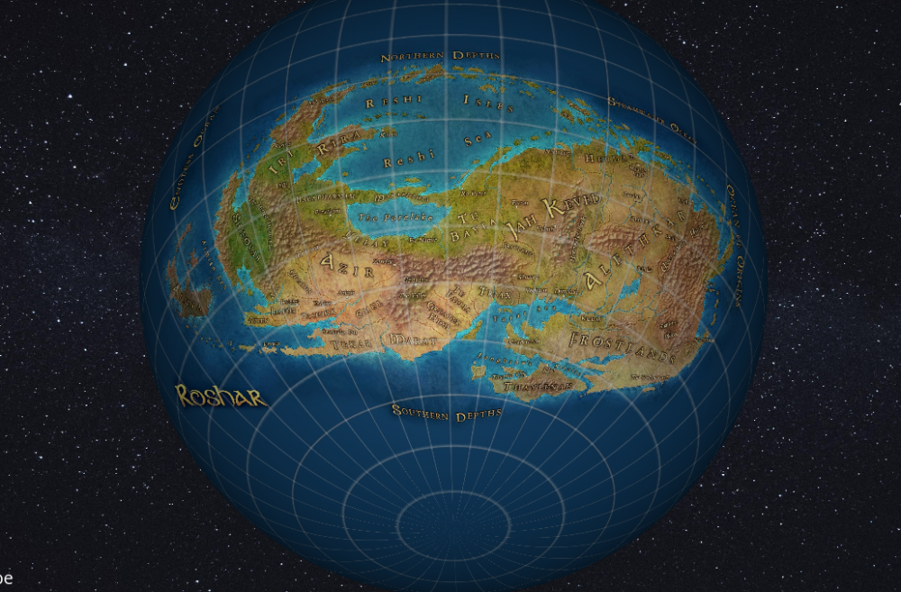
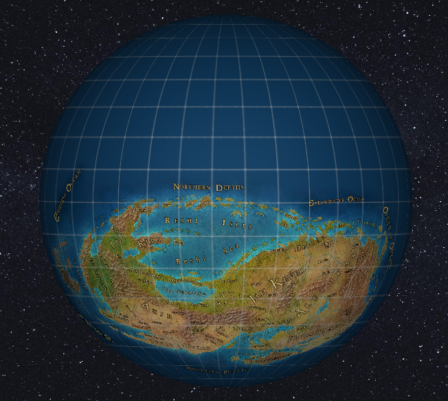
Finally got around to something I've wanted to do for a long time. Make a globe of Roshar!
The site doesn't work very well on mobile, so here's some images:
First need to say thanks to u/Stoneward13 on Reddit who created the beautiful high-resolution map that I used for this.
The trick was getting the projection right. @Otto Didact identified the map from Oathbringer as an "azimuthal equidistant" projection while the "Map To Globe" site I used required an equirectangular projection. With a bit of patience I finally discovered a way in QGIS to mark coordinates on a raster image and have that program pump out the equirectangular projection!
So here you have it. I've positioned it at the appropriate latitude, with the equator passing through the center of Kadrix island. To anybody not aware, yes, Roshar is mostly ocean. Brandon has stated that there are no other major landmasses. It's possible that ice caps exist, (seems like Yalb mentions tales of a southern ice cap?) but I haven't speculated on that. Maybe I'll circle back around to it. The continent is a bit smaller than Asia. More details on that sort of thing here:
Under the "Options' menu you can toggle longitude/latitude lines. (if comparing with the Oathbringer map, typical lines won't line up right because Roshar uses 200 "degrees" in a circle) And play with some other tweaks, like lighting.
But my favorite feature is the "Measure distance" button. Click that and enter Roshar's radius (about 5663 km) and it report the distance between two points you select. Unfortunately, last I checked it looks like the measure distance feature is broken. Thankfully such a feature was added to roshar.17thshard.com so at least there's that. ![]()
Edit: We have since realized that the projection used for this was just a little bit off. An azumithal equidistant projection works by picking a center point--the one that equidistant azumiths are taken from. (It doesn't have to be the center of the map you end up with. You can project the entire globe and then crop out any portion of it that you want.) While working on latitude/longitude lines for roshar.17thshard.com we realized the center point we were using was off. That's the point I used to turn the 2D map back into a globe, so the globe is a little off. Not by a lot, but I wanted to note it here. More details about what the center point should be:


2 Comments
Recommended Comments